Bleiswijk
Village in South Holland, Netherlands

Flag

Seal
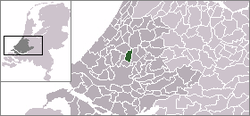
Location in South Holland
 Netherlands
 South Holland
 Lansingerland
 (January 2020)
2665
Bleiswijk (Dutch: [ˈblɛisʋɛik] ⓘ) is a town and former municipality in the western Netherlands, in the province of South Holland.
Demographics
The municipality had a population of 10,222 in 2006, and covered an area of 21.96 km2 (8.48 sq mi) of which 0.83 km2 (0.32 sq mi) is water. On 1 January 2007, the town was merged with neighbouring towns Bergschenhoek and Berkel en Rodenrijs to form the new municipality Lansingerland.
According to the January 2020 census, its population was 10,895.[1]
References
- ^ "Kerncijfers wijken en buurten 2020" (in Dutch). CBS. Retrieved November 13, 2020.
External links
Wikimedia Commons has media related to Bleiswijk.
- Official website
- location on map(OSM)
- Het weer in Bleiswijk
- v
- t
- e
Populated places in the municipality of Lansingerland
- Bergschenhoek
- Berkel en Rodenrijs
- Bleiswijk
Authority control databases | |
|---|---|
| International |
|
| National |
|
| Geographic |
|
 | This South Holland location article is a stub. You can help Wikipedia by expanding it. |
- v
- t
- e


