County of Tatchera
Cadastral in Victoria, Australia
| Tatchera Victoria | |||||||||||||||
|---|---|---|---|---|---|---|---|---|---|---|---|---|---|---|---|
 Location in Victoria | |||||||||||||||
| |||||||||||||||
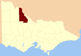
The County of Tatchera is one of the 37 counties of Victoria which are part of the cadastral divisions of Australia, used for land titles. It is located to the south of the Murray River, and to the south west of Swan Hill, with its western boundary at 143°E, and part of the southern boundary at 36°S.
Parishes
Parishes include:
- Bael Bael, Victoria
- Benjeroop, Victoria
- Berriwillock, Victoria
- Boga, Victoria
- Boort, Victoria
- Budgerum East, Victoria
- Budgerum West, Victoria
- Burra, Victoria
- Cannie, Victoria
- Carapugna, Victoria
- Castle Donnington, Victoria
- Chillingollah, Victoria
- Chinangin, Victoria
- Coonimur, Victoria
- Cooroopajerrup, Victoria
- Dartagook, Victoria
- Gnarwee, Victoria
- Gredgwin, Victoria
- Jeruk, Victoria
- Kalpienung, Victoria
- Kaneira, Victoria
- Kooem, Victoria
- Koorangie, Victoria
- Koorkahb, Victoria
- Koro-Ganeit, Victoria
- Korrak Korrak, Victoria
- Kunat Kunat, Victoria
- Lalbert, Victoria
- Leaghur, Victoria
- Marmal, Victoria
- Meatian, Victoria
- Meering, Victoria
- Meering West, Victoria
- Meran, Victoria
- Mirkoo, Victoria
- Mumbel, Victoria
- Murnungin, Victoria
- Narrung, Victoria
- Ninveunook, Victoria
- Nowie, Victoria
- Nullawil, Victoria
- Nyrraby, Victoria
- Pental Island, Victoria
- Perrit Perrit, Victoria
- Piangil, Victoria
- Piangil West, Victoria
- Pines, Victoria
- Polisbet, Victoria
- Quambatook, Victoria
- Talgitcha, Victoria
- Tittybong, Victoria
- Toort, Victoria
- Towan, Victoria
- Towaninny, Victoria
- Turoar, Victoria
- Tyntynder, Victoria
- Tyntynder North, Victoria
- Tyntynder West, Victoria
- Ultima, Victoria
- Waitchie, Victoria
- Wakool, Victoria
- Wandown, Victoria
- Wangie, Victoria
- Wewin, Victoria
- Woorinen, Victoria
- Yungiera, Victoria
References
- Vicnames, place name details
- Research aids, Victoria 1910
- County of Tatchera, Cadastral map showing county and parish boundaries, categories of lands holdings and reserves., 1880s. National Library of Australia
- v
- t
- e
- Anglesey
- Benambra
- Bendigo
- Bogong
- Borung
- Bourke
- Buln Buln
- Croajingolong
- Dalhousie
- Dargo
- Delatite
- Dundas
- Evelyn
- Follett
- Gladstone
- Grant
- Grenville
- Gunbower
- Hampden
- Heytesbury
- Kara Kara
- Karkarooc
- Lowan
- Millewa
- Moira
- Mornington
- Normanby
- Polwarth
- Ripon
- Rodney
- Talbot
- Tambo
- Tanjil
- Tatchera
- Villiers
- Weeah
- Wonnangatta
35°30′S 143°30′E / 35.500°S 143.500°E / -35.500; 143.500


