Keitele
You can help expand this article with text translated from the corresponding article in Finnish. (June 2023) Click [show] for important translation instructions.
- Machine translation, like DeepL or Google Translate, is a useful starting point for translations, but translators must revise errors as necessary and confirm that the translation is accurate, rather than simply copy-pasting machine-translated text into the English Wikipedia.
- Do not translate text that appears unreliable or low-quality. If possible, verify the text with references provided in the foreign-language article.
- You must provide copyright attribution in the edit summary accompanying your translation by providing an interlanguage link to the source of your translation. A model attribution edit summary is
Content in this edit is translated from the existing Finnish Wikipedia article at [[:fi:Keitele]]; see its history for attribution. - You may also add the template
{{Translated|fi|Keitele}}to the talk page. - For more guidance, see Wikipedia:Translation.
Municipality in Northern Savonia, Finland

Coat of arms
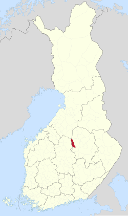
Location of Keitele in Finland
 Finland
 (2018-01-01)[1]
(2023-12-31)[2]
72600
Keitele is a municipality of Finland.
It is part of the Northern Savonia region. The municipality has a population of 2,035 (31 December 2023)[2] and covers an area of 578.30 square kilometres (223.28 sq mi) of which 96.59 km2 (37.29 sq mi) is water.[1] The population density is 4.21 inhabitants per square kilometre (10.9/sq mi).
Neighbour municipalities are Pielavesi, Pihtipudas, Tervo, Vesanto and Viitasaari.
Despite its name, the municipality is not located by the lake Keitele. The shortest distance between the municipality and the lake is roughly ten kilometers.
The municipality is unilingually Finnish.
Notable people born in Keitele
- Ilmari Tossavainen (1887–1978)
- Kalle Matilainen (1903–1973)
- Rakel Hiltunen (1940–)
- Mikko Härkin (1979–)
References
- ^ a b "Area of Finnish Municipalities 1.1.2018" (PDF). National Land Survey of Finland. Retrieved 30 January 2018.
- ^ a b c "Population growth biggest in nearly 70 years". Population structure. Statistics Finland. 26 April 2024. ISSN 1797-5395. Retrieved 29 April 2024.
- ^ "Population according to age (1-year) and sex by area and the regional division of each statistical reference year, 2003–2020". StatFin. Statistics Finland. Retrieved 2 May 2021.
- ^ a b "Luettelo kuntien ja seurakuntien tuloveroprosenteista vuonna 2023". Tax Administration of Finland. 14 November 2022. Retrieved 7 May 2023.
External links
![]() Media related to Keitele at Wikimedia Commons
Media related to Keitele at Wikimedia Commons
- Municipality of Keitele – Official website
Places adjacent to Keitele | |
|---|---|


- v
- t
- e

Authority control databases | |
|---|---|
| International |
|
| National |
|
| Geographic |
|
 | This Eastern Finland location article is a stub. You can help Wikipedia by expanding it. |
- v
- t
- e


