Mount Limbert
Mountain in the state of Idaho

Mount Limbert
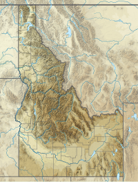
Boise and Custer counties, Idaho, U.S.
Mount Limbert, at 10,385 feet (3,165 m) above sea level is the 12th highest peak in the Sawtooth Range of Idaho. The peak is located in the Sawtooth Wilderness of Sawtooth National Recreation Area on the border of Boise and Custer counties. The peak is located 0.54 mi (0.87 km) southwest of Mount Carter, its line parent.[2][3][4]
See also
 Idaho portal
 Mountains portal

- List of peaks of the Sawtooth Range (Idaho)
- List of mountains of Idaho
- List of mountain peaks of Idaho
- List of mountain ranges in Idaho
References
- v
- t
- e
 | This Geographical stub article in Custer County, Idaho is a stub. You can help Wikipedia by expanding it. |
- v
- t
- e
State of Idaho | |
|---|---|
Boise (capital) | |
| Topics |
|
| Society | |
| Regions | |
| Larger cities | |
| Smaller cities | |
| Counties |
|
 Idaho portal Idaho portal | |


