Poptún
Place in El Petén, Guatemala
16°19′20″N 89°25′20″W / 16.32222°N 89.42222°W / 16.32222; -89.42222 Guatemala
 El Petén
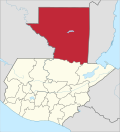
Poptún is a municipality in the El Petén department of Guatemala. It covers an area of 1,128 km2, and had a population of 35,663 at the 2002 Census; the latest official estimate (as at mid-2012) was 64,988. It is some 385 km from Guatemala City. Since 1989, Military Zone 23 in Poptún has been the home of the Guatemalan Army's elite Kaibiles special operations force.
Geographic location
Poptún is in the southeast part of Petén Department and communicates with the rest of the Republic of Guatemala via a 100-km highway to Flores.
Places adjacent to Poptún | ||||||||||||||||
|---|---|---|---|---|---|---|---|---|---|---|---|---|---|---|---|---|
| ||||||||||||||||


See also
 Guatemala portal
 Geography portal


References
- ^ "Elecciones de Guatemala de 2011" (PDF). Prensa Libre (in Spanish). Guatemala. 2011. Archived from the original (PDF) on 26 November 2011. Retrieved 29 June 2015.
- ^ a b "Municipios del Departamento de El Petén". SEGEPLAN (in Spanish). Guatemala. Archived from the original on July 7, 2015. Retrieved 7 July 2015.

3.
Authority control databases | |
|---|---|
| International |
|
| National |
|
| Other |
|
<>https://www.tse.org.gt
acuerdo número 12-2019 - Tribunal Supremo Electoral16°19′19″N 89°25′19″W / 16.322°N 89.422°W / 16.322; -89.422
 | This Guatemala location article is a stub. You can help Wikipedia by expanding it. |
- v
- t
- e


