Radohova Vas
Place in Lower Carniola, Slovenia
45°56′37.57″N 14°51′41.3″E / 45.9437694°N 14.861472°E / 45.9437694; 14.861472 Slovenia
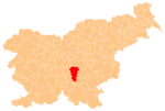
 (2002)
Radohova Vas (pronounced [ˈɾaːdɔxɔʋa ˈʋaːs]; Slovene: Radohova vas, German: Rodockendorf[2]) is a village southeast of Šentvid pri Stični in the Municipality of Ivančna Gorica in central Slovenia. The area is part of the historical region of Lower Carniola. The municipality is now included in the Central Slovenia Statistical Region.[3]
In the early 20th century an Early Iron Age burial ground was discovered and partially excavated west of the settlement.[4]
Gallery
-
 Historical postcard of Radohova Vas

References
- ^ Statistical Office of the Republic of Slovenia
- ^ Leksikon občin kraljestev in dežel zastopanih v državnem zboru, vol. 6: Kranjsko. 1906. Vienna: C. Kr. Dvorna in Državna Tiskarna, p. 102.
- ^ Ivančna Gorica municipal site
- ^ "EŠD 15718". Registry of Immovable Cultural Heritage (in Slovenian). Ministry of Culture of the Republic of Slovenia. Retrieved 2 September 2011.
External links
- Radohova Vas on Geopedia
- v
- t
- e
Administrative seat: Ivančna Gorica
- Jurčič House
- Kravjek Castle
- Krka Cave
- Podsmreka Castle
- Stična Abbey
 | This article about the Municipality of Ivančna Gorica in Slovenia is a stub. You can help Wikipedia by expanding it. |
- v
- t
- e


