Arrondissement de Cobourg
| Arrondissement de Cobourg Landkreis Coburg | |
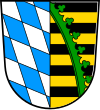 Héraldique |  Localisation |
| Administration | |
|---|---|
| Pays |  Allemagne Allemagne |
| Land |  Bavière Bavière |
| District (Regierungsbezirk) | Haute-Franconie |
| Chef-lieu | Cobourg |
| Préfet (Landrat) | Michael C. Busch |
| Partis au pouvoir | SPD |
| Code arrondissemental (Kreisschlüssel) | 09 4 73 |
| Immatriculation | CO, NEC |
| Communes | 17 |
| Démographie | |
| Population | 86 544 hab. (31 décembre 2021) |
| Densité | 147 hab./km2 |
| Géographie | |
| Superficie | 590,7 km2 |
| Localisation | |
 | |
| Liens | |
| Site web | www.landkreis-coburg.de |
modifier  | |
L'arrondissement de Cobourg est un arrondissement (Landkreis en allemand) de Bavière (Allemagne) situé dans le district (Regierungsbezirk en allemand) de Haute-Franconie. Son chef lieu est Cobourg.
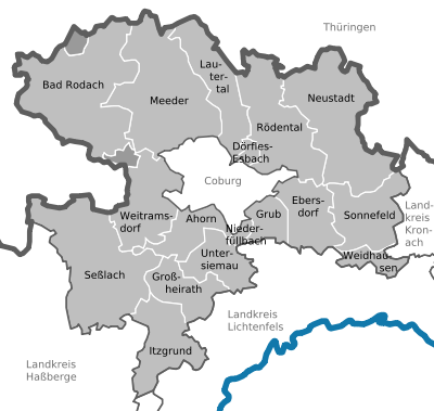
Villes, communes et communautés d'administration
(nombre d'habitants en 2006)
Städte
- Bad Rodach (6 478)
- Neustadt bei Coburg, Große Kreisstadt (16 428)
- Rödental (13 654)
- Seßlach (4 074)
- Grub am Forst avec les communes membres Grub am Forst et Niederfüllbach
Gemeindefreie Gebiete (6,02 km2)
- Callenberger Forst-West (2,32 km2)
- Gellnhausen (2,80 km2)
- Köllnholz (0,90 km2)
- Ahorn (4 480)
- Dörfles-Esbach (3 841)
- Ebersdorf bei Coburg (6 248)
- Großheirath (2 564)
- Grub am Forst (3 108)
- Itzgrund (2 323)
- Lautertal (4 159)
- Meeder (4 015)
- Niederfüllbach (1 672)
- Sonnefeld (5 226)
- Untersiemau (4 245)
- Weidhausen bei Coburg (3 307)
- Weitramsdorf (5 182)
Sur les autres projets Wikimedia :
- Arrondissement de Cobourg, sur Wikimedia Commons

 Portail de la Bavière


