Denu
District capital in Volta Region, Ghana
Denu Adafienu Dylan | |
---|---|
District capital | |
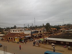
![]() Aerial view of Denu junction | |
06°06′04″N 01°08′52″E / 6.10111°N 1.14778°E / 6.10111; 1.14778 | |
Country | Ghana |
Region | Volta Region |
District | Ketu South Municipal |
Elevation | 8 m (26 ft) |
Time zone | GMT |
• Summer (DST) | GMT |
Area code | +233 36 25 |
Denu is a small town which is the capital of Ketu South Municipal, a district on the south-eastern corner of the Volta Region of Ghana, next to Aflao the border town with Togo. The name Denu literally means by the boundary.[1][2] The town is sandwiched between the sea and lagoon on its south and north respectively.
See also
- Ketu South (Ghana parliament constituency)
References
External links
- Ketu South District on GhanaDistricts.com
- v
- t
- e
District capitals in Ghana
![Location of Ashanti Region in Ghana](http://upload.wikimedia.org/wikipedia/commons/thumb/c/c3/Ashanti_in_Ghana_2018.svg/45px-Ashanti_in_Ghana_2018.svg.png)
![Location of Bono Region in Ghana](http://upload.wikimedia.org/wikipedia/commons/thumb/c/c3/Bono_in_Ghana_2018.svg/45px-Bono_in_Ghana_2018.svg.png)
![Location of Central Region in Ghana](http://upload.wikimedia.org/wikipedia/commons/thumb/e/e7/Central_in_Ghana_2018.svg/45px-Central_in_Ghana_2018.svg.png)
![Location of Eastern Region in Ghana](http://upload.wikimedia.org/wikipedia/commons/thumb/4/4d/Eastern_in_Ghana_2018.svg/45px-Eastern_in_Ghana_2018.svg.png)
![Location of Oti Region in Ghana](http://upload.wikimedia.org/wikipedia/commons/thumb/d/d9/Oti_in_Ghana_2018.svg/45px-Oti_in_Ghana_2018.svg.png)
![Location of Volta Region in Ghana](http://upload.wikimedia.org/wikipedia/commons/thumb/e/ec/Volta_in_Ghana_2018.svg/45px-Volta_in_Ghana_2018.svg.png)
![Location of Western Region in Ghana](http://upload.wikimedia.org/wikipedia/commons/thumb/8/83/Western_in_Ghana_2018.svg/45px-Western_in_Ghana_2018.svg.png)
This Volta Region location article is a stub. You can help Wikipedia by expanding it. |
- v
- t
- e