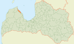
Roja Municipality
Municipality of Latvia
Municipality in Latvia
Roja Municipality Rojas novads | |
|---|---|
 Flag  Coat of arms | |
 | |
| Country |  Latvia Latvia |
| Formed | 2009 |
| Centre | Roja, Latvia |
| Government | |
| • Council Chair | Eva Kārkliņa (LZP) |
| Area | |
| • Total | 200.61 km2 (77.46 sq mi) |
| • Land | 196.95 km2 (76.04 sq mi) |
| • Water | 3.66 km2 (1.41 sq mi) |
| Population (2021)[2] | |
| • Total | 3,390 |
| • Density | 17/km2 (44/sq mi) |
| Website | www |
Roja Municipality (Latvian: Rojas novads, Livonian: Rūoj mōgõn) is a former municipality in Courland, Latvia. The municipality was formed in 2009 by merging Mērsrags parish and Roja parish the administrative centre being Roja. Since 2010 a separate Mērsrags municipality has been created. The population in 2020 was 3,368.[3]
On 1 July 2021, Roja Municipality ceased to exist and its territory was merged into Talsi Municipality.[4]
See also
- Administrative divisions of Latvia (2009)
References
- ^ Error: Unable to display the reference properly. See the documentation for details.
- ^ Error: Unable to display the reference properly. See the documentation for details.
- ^ "ISG020. Population number and its change by statistical region, city, town, 21 development centres and county". Central Statistical Bureau of Latvia. 2020-01-01. Retrieved 2021-02-12.
- ^ [1] Law on Administrative Territories and Populated Areas
- v
- t
- e
Former first-level administrative divisions of Latvia (2009–2021)

- Aglona
- Aizkraukle
- Aizpute
- Aknīste
- Aloja
- Alsunga
- Alūksne
- Amata
- Ape
- Auce
- Ādaži
- Babīte
- Baldone
- Baltinava
- Balvi
- Bauska
- Beverīna
- Brocēni
- Burtnieki
- Carnikava
- Cesvaine
- Cēsis
- Cibla
- Dagda
- Daugavpils
- Dobele
- Dundaga
- Durbe
- Engure
- Ērgļi
- Garkalne
- Grobiņa
- Gulbene
- Iecava
- Ikšķile
- Ilūkste
- Inčukalns
- Jaunjelgava
- Jaunpiebalga
- Jaunpils
- Jelgava
- Jēkabpils
- Kandava
- Kārsava
- Kocēni
- Koknese
- Krāslava
- Krimulda
- Krustpils
- Kuldīga
- Ķegums
- Ķekava
- Lielvārde
- Limbaži
- Līgatne
- Līvāni
- Lubāna
- Ludza
- Madona
- Mazsalaca
- Mālpils
- Mārupe
- Mērsrags
- Naukšēni
- Nereta
- Nīca
- Ogre
- Olaine
- Ozolnieki
- Pārgauja
- Pāvilosta
- Pļaviņas
- Preiļi
- Priekule
- Priekuļi
- Rauna
- Rēzekne
- Riebiņi
- Roja
- Ropaži
- Rucava
- Rugāji
- Rundāle
- Rūjiena
- Salacgrīva
- Sala
- Salaspils
- Saldus
- Saulkrasti
- Sēja
- Sigulda
- Skrīveri
- Skrunda
- Smiltene
- Stopiņi
- Strenči
- Talsi
- Tērvete
- Tukums
- Vaiņode
- Valka
- Varakļāni
- Vārkava
- Vecpiebalga
- Vecumnieki
- Ventspils
- Viesīte
- Viļaka
- Viļāni
- Zilupe
57°30′30″N 22°48′33″E / 57.50833°N 22.80917°E / 57.50833; 22.80917
| Authority control databases: National |
|
|---|
 | This Courland location article is a stub. You can help Wikipedia by expanding it. |
- v
- t
- e


