Tērvete Municipality
Municipality of Latvia
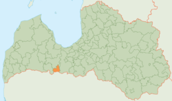
Municipality in Latvia
Tērvete Municipality Tērvetes novads | |
|---|---|
 Flag  Coat of arms | |
 | |
| Country |  Latvia Latvia |
| Formed | 2002 |
| Centre | Zelmeņi |
| Government | |
| • Council Chair | Dace Reinika (Our Home Is Here/LZS) |
| Area | |
| • Total | 223.79 km2 (86.41 sq mi) |
| • Land | 219.46 km2 (84.73 sq mi) |
| • Water | 4.33 km2 (1.67 sq mi) |
| Population (2021)[2] | |
| • Total | 3,273 |
| • Density | 15/km2 (38/sq mi) |
| Website | www |
Tērvete Municipality (Latvian: Tērvetes novads) is a former municipality in Semigallia, Latvia. The municipality was formed in 2002 by merging Augstkalne parish, Bukaiši parish and Tērvete parish, the administrative centre being Zelmeņi. The population in 2020 was 3,302.[3]
On 1 July 2021, Tērvete Municipality ceased to exist and its territory was merged into Dobele Municipality.[4]
Geography
The largest rivers are Auce, Ālave, Govaine, Krievaine, Reņģe, Skujaine, Svēpaine, Svētaine, Svete, Tērvete.
History
The county of Tērvete is located in the territory of the ancient Semigallian Territory, which was first mentioned in the Livonian Chronicle of Henry in the XXIII, section 4, in the context of the events of 1219, as the "province called Tervete" (Latin: provincia, que Thervetene vocatur ).
See also
References
- ^ Error: Unable to display the reference properly. See the documentation for details.
- ^ Error: Unable to display the reference properly. See the documentation for details.
- ^ "ISG020. Population number and its change by statistical region, city, town, 21 development centres and counties". Central Statistical Bureau of Latvia. 2020-01-01. Retrieved 2021-02-12.
- ^ [1] Law on Administrative Territories and Populated Areas
External links
 Media related to Tērvete Municipality at Wikimedia Commons
- v
- t
- e
Former first-level administrative divisions of Latvia (2009–2021)

- Aglona
- Aizkraukle
- Aizpute
- Aknīste
- Aloja
- Alsunga
- Alūksne
- Amata
- Ape
- Auce
- Ādaži
- Babīte
- Baldone
- Baltinava
- Balvi
- Bauska
- Beverīna
- Brocēni
- Burtnieki
- Carnikava
- Cesvaine
- Cēsis
- Cibla
- Dagda
- Daugavpils
- Dobele
- Dundaga
- Durbe
- Engure
- Ērgļi
- Garkalne
- Grobiņa
- Gulbene
- Iecava
- Ikšķile
- Ilūkste
- Inčukalns
- Jaunjelgava
- Jaunpiebalga
- Jaunpils
- Jelgava
- Jēkabpils
- Kandava
- Kārsava
- Kocēni
- Koknese
- Krāslava
- Krimulda
- Krustpils
- Kuldīga
- Ķegums
- Ķekava
- Lielvārde
- Limbaži
- Līgatne
- Līvāni
- Lubāna
- Ludza
- Madona
- Mazsalaca
- Mālpils
- Mārupe
- Mērsrags
- Naukšēni
- Nereta
- Nīca
- Ogre
- Olaine
- Ozolnieki
- Pārgauja
- Pāvilosta
- Pļaviņas
- Preiļi
- Priekule
- Priekuļi
- Rauna
- Rēzekne
- Riebiņi
- Roja
- Ropaži
- Rucava
- Rugāji
- Rundāle
- Rūjiena
- Salacgrīva
- Sala
- Salaspils
- Saldus
- Saulkrasti
- Sēja
- Sigulda
- Skrīveri
- Skrunda
- Smiltene
- Stopiņi
- Strenči
- Talsi
- Tērvete
- Tukums
- Vaiņode
- Valka
- Varakļāni
- Vārkava
- Vecpiebalga
- Vecumnieki
- Ventspils
- Viesīte
- Viļaka
- Viļāni
- Zilupe
Authority control databases | |
|---|---|
| National |
|
| Geographic |
|
56°28′46″N 23°23′23″E / 56.47944°N 23.38972°E / 56.47944; 23.38972
 | This Semigallia location article is a stub. You can help Wikipedia by expanding it. |
- v
- t
- e


